Interactive Boston Map
Boston Map > Interactive Boston Maps
 Boston is the center of banking and insurance for Massachusetts and modern highrises stand juxtaposed amongst historical
buildings that are centuries old. The downtown area is modern and completely walkable and the public schools are
nationally recognized. Boston is also home to Harvard University, founded in 1636 as the first institution of higher
learning in North America, and the largest number of highly ranked universities in the country including Boston
University, MIT, Northeastern, and Tufts. The city is easily reached by rail, bus or airplane to Logan International
Airport. A well-laid out system of subways, buses, trolleys, boats, and commuter trains provide transportation within city limits.
Boston is the center of banking and insurance for Massachusetts and modern highrises stand juxtaposed amongst historical
buildings that are centuries old. The downtown area is modern and completely walkable and the public schools are
nationally recognized. Boston is also home to Harvard University, founded in 1636 as the first institution of higher
learning in North America, and the largest number of highly ranked universities in the country including Boston
University, MIT, Northeastern, and Tufts. The city is easily reached by rail, bus or airplane to Logan International
Airport. A well-laid out system of subways, buses, trolleys, boats, and commuter trains provide transportation within city limits.
Interactive Boston Maps
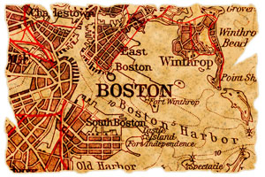
The center of Boston, Massachusetts is located at about 42.35 degrees North (latitude) and 71.08 degrees West (longitude). The city occupies approximately 48.4 square miles in land area; according to the 2010 census, Boston's population was 617,594.
|
Swan Boats in Boston Public Garden
|
This Boston directory provides convenient access to a broad spectrum of enterprises that are located in Boston, Massachusetts. In-depth information and news about Boston can be found on these regional Boston Libraries and Boston Newspapers pages, respectively. Visitors to Boston will find this Boston USA Guide website useful.
Copyright © 2012-2026 Zeducorp.
All rights reserved.
All rights reserved.